Features
Everything you need to ride the hills
Flamap brings climb discovery, route planning and navigation into one focused cycling app.
01 — Climb discovery
Find the climbsaround you.
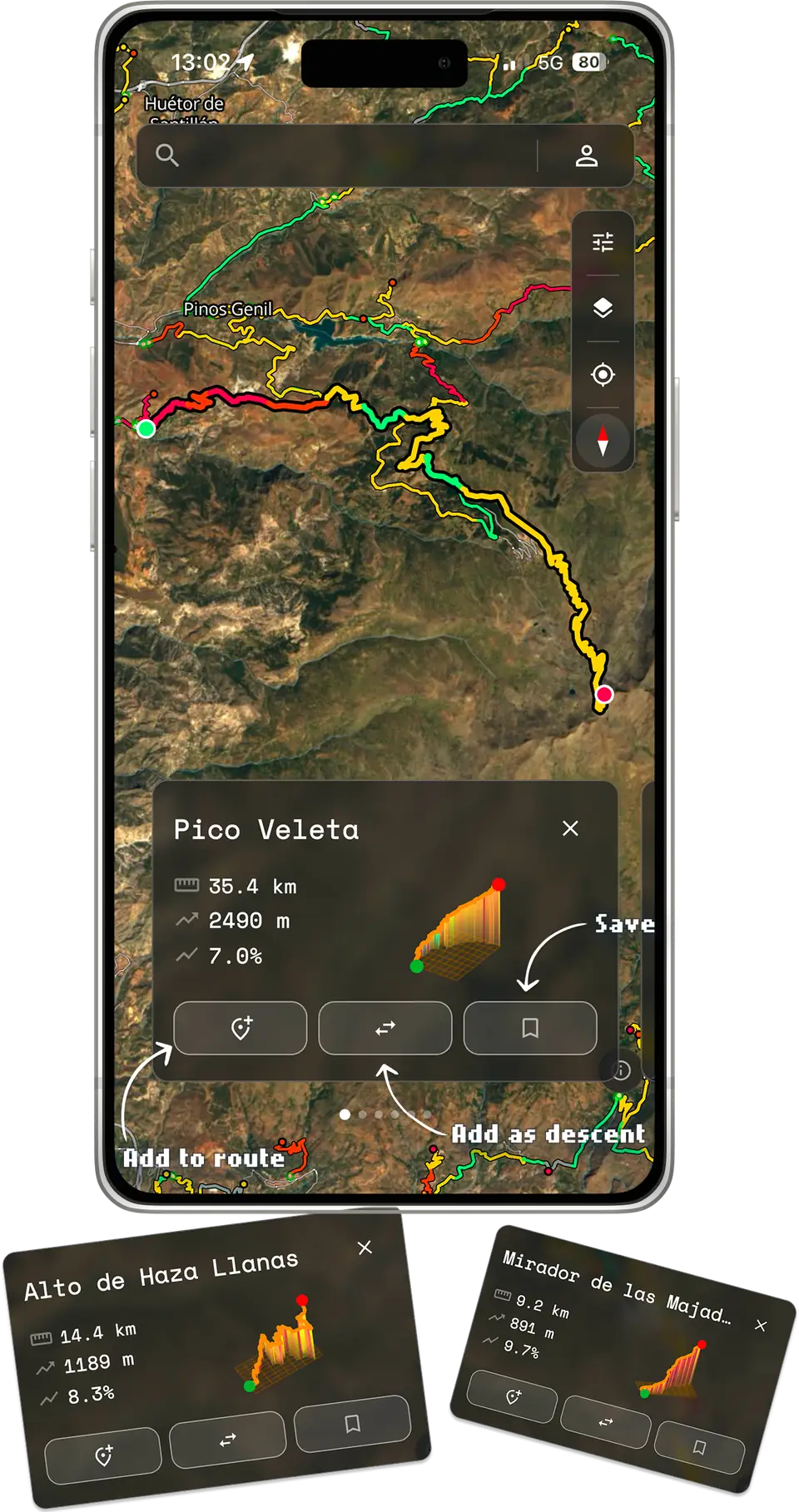
Every climb and descent near you, drawn on the map and colored by gradient. Tap one to see it in full, then go ride it.
- Colored by gradient, from green to deep red
- Add any climb to a route — ascent or descent
- Save the ones you want to come back to
02 — Climb profiles
Every climb,categorized.
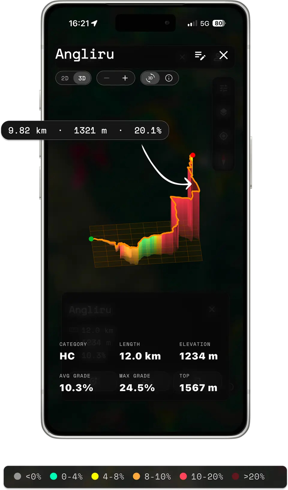
UCI-style categories, full elevation profiles and a 3D preview, so you know exactly what you are riding into.
- HC to Cat 4, graded by length and steepness
- 3D preview you can spin and inspect
- Length, elevation, average and max gradient
03 — Route planning
Tap the map.Get a route.
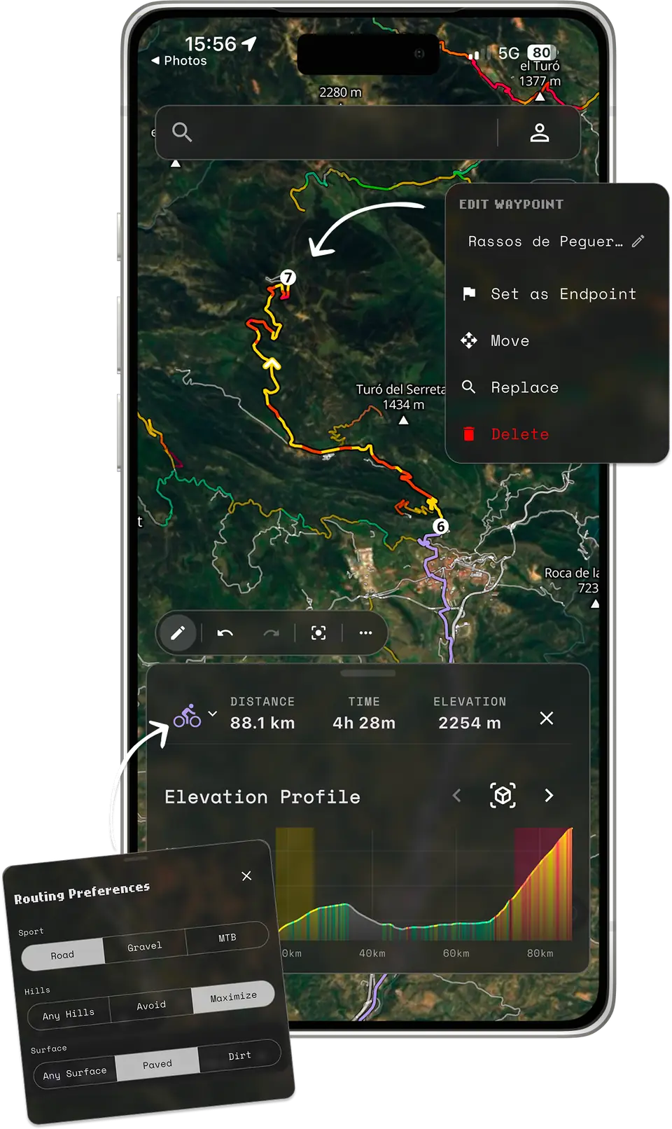
Build a route in a couple of taps, then reshape it point by point until it is the ride you wanted.
- Road, gravel or MTB routing profiles
- Seek out the hills or avoid them; paved or dirt
- Move, replace or delete any waypoint
04 — Surface and stops
Know the surfacebefore you ride.
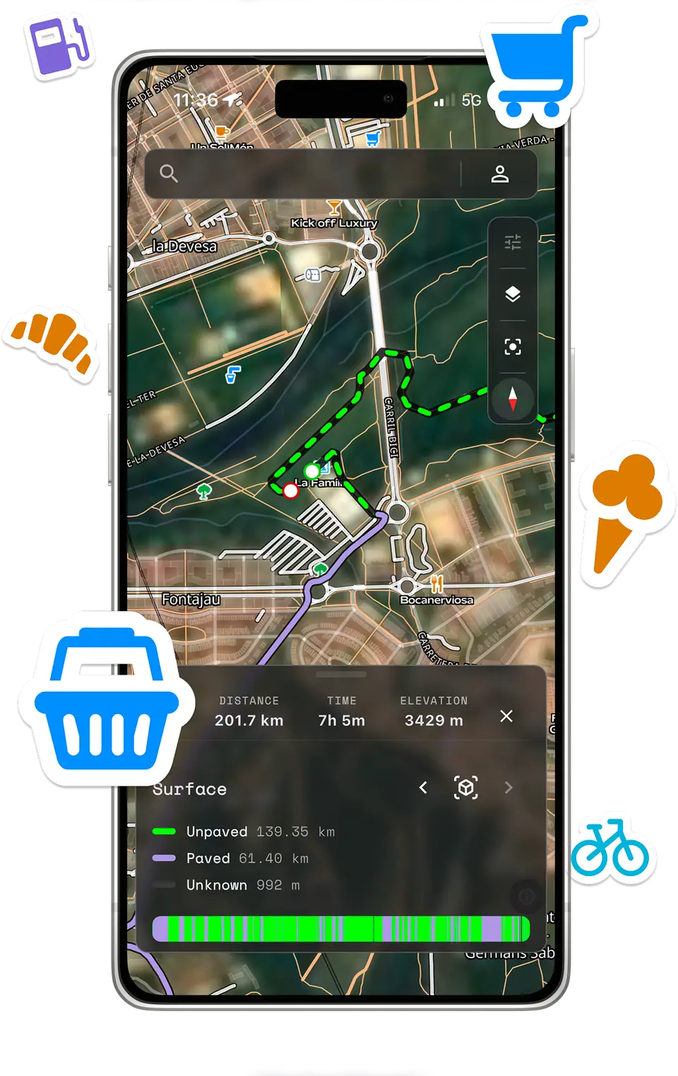
See how much of your route is paved, unpaved or unknown before you leave, and where the fountains, shops and cafes are along the way.
- Paved vs unpaved breakdown for every route
- Water, food and toilets on the map
- Plan resupply on the long days out
05 — Activity tracking
Every ride.Every effort.
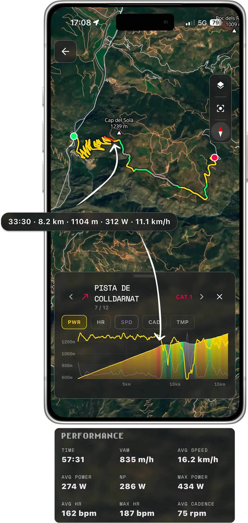
Record in the app or import GPX and FIT files, then break the ride down climb by climb.
- Power, heart rate, speed, cadence and temperature
- Per-climb splits with VAM and category
- Time, average, max and weighted average power
Also in the app
Every route, ready to ride.

Navigate
Turn-by-turn guidance so you can keep your eyes on the road.
Save
Keep the route in your library and pull it up whenever you want to ride it.
Share
Send a route to anyone with a link — climbs, profile and all.
Download
Export any route as a standard GPX or FIT file and load it onto your head unit or into another app.